
MILESTONES
Four Milestones from the ancient road between London and Hastings survive within Farnborough. They are all now listed monuments.
Three are on what became the Turnpike route, at Locksbottom, Farnborough and Green Street Green. The fourth is in Tubbenden Lane, the road leading from Farnborough to Orpington.
From the dates given (see below), the one in Tubbenden Lane is the original monument, the other three are nineteenth century replacements.
The local map of 1799 shows an earlier Milestone 15 being located on the original turnpike route on Old Hill. This became redundent when the route was changed to go through Green Street Green, and the stone is now lost.
The below descriptions all refer to the New Cross turnpike of 1718, however the Bromley to Sevenoaks section was not established until 1749.
Milestone 13, Hastings Road, Locksbottom (north side)
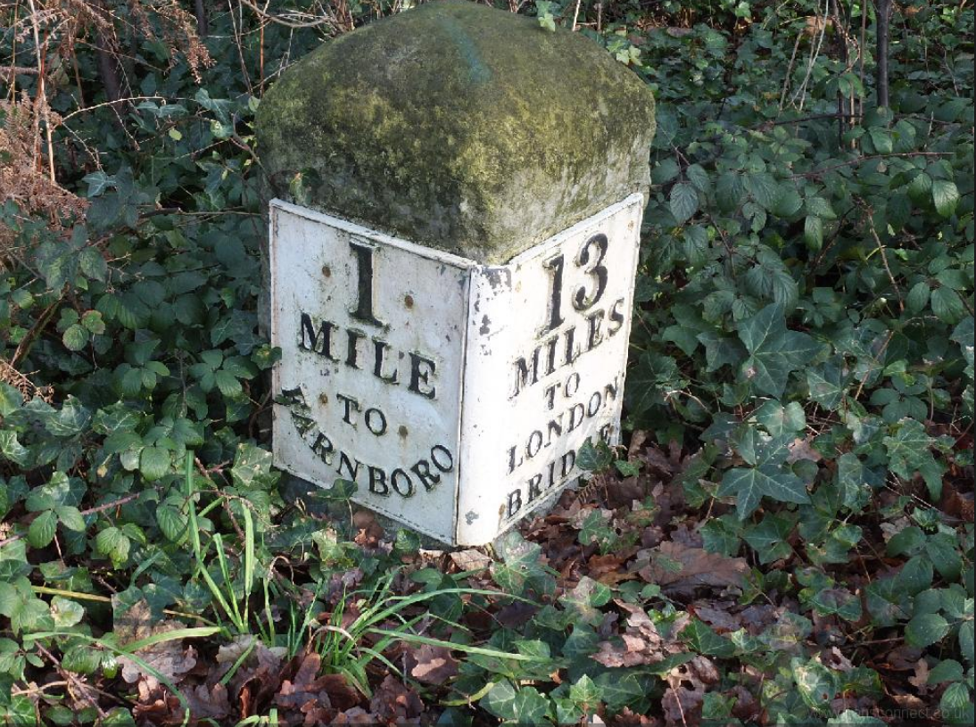 |
Milestone at TQ 46 NW 5/504 TQ 4286 6514 Milestone. Early C19. Limestone milestone with rounded top and inscription plates. One plate reads 13/MILES/TO/LONDON/BRIDGE, the other 1/MILE/TO/ FARNBORO(UGH). Located on the New Cross Turnpike road of 1718. |
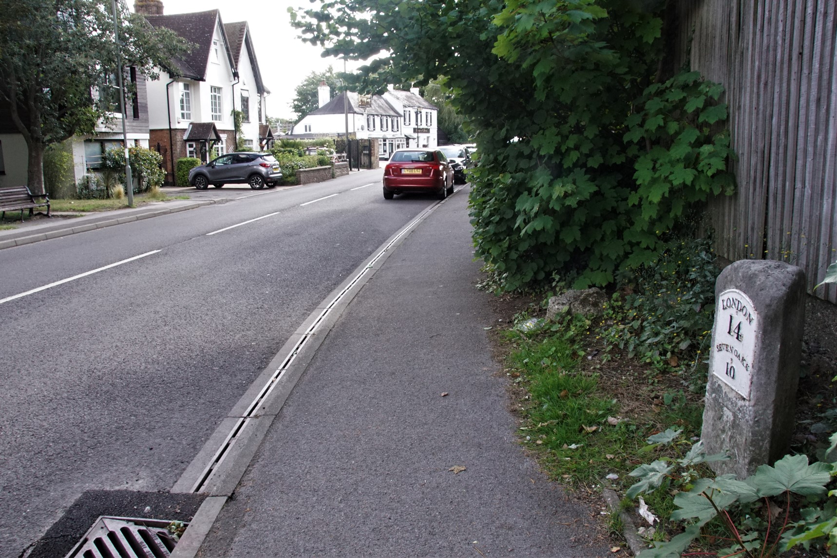
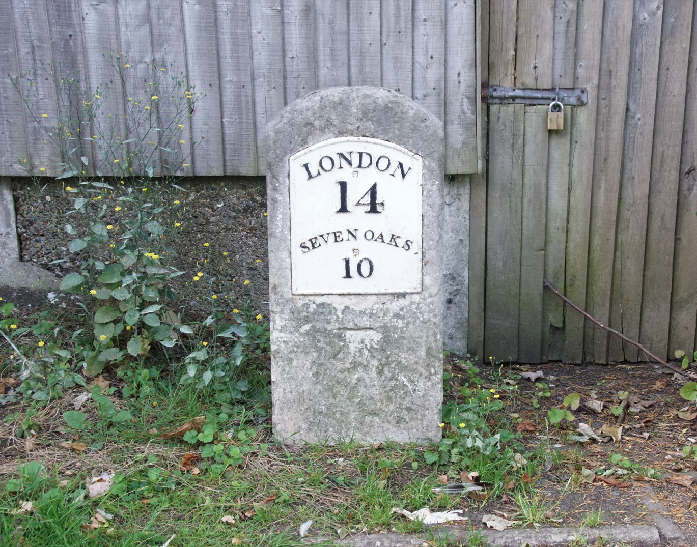
Milestone 14, High Street, Farnborough (south side)
Milestone adjacent to TQ 4364 SE 12/308 Electricity Sub StationMilestone. Early/mid C19. Limestone.
Thin, rectangular milestone with plate which reads LONDON/14/SEVENOAKS/10. Located on the New Cross Turnpike road of 1718.
 |
 |
Milestone 15, Green Street Green
Milestone at junction TQ 46 SE 10/300 of
Sevenoaks Road with Farnborough Hill Milestone. Early/mid C19. Limestone.
Thin, rectangular milestone with plate which reads SEVENOAKS/9/LONDON/15. Located on the New Cross Turnpike road of 1718.
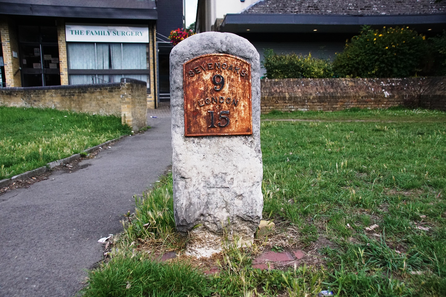 |
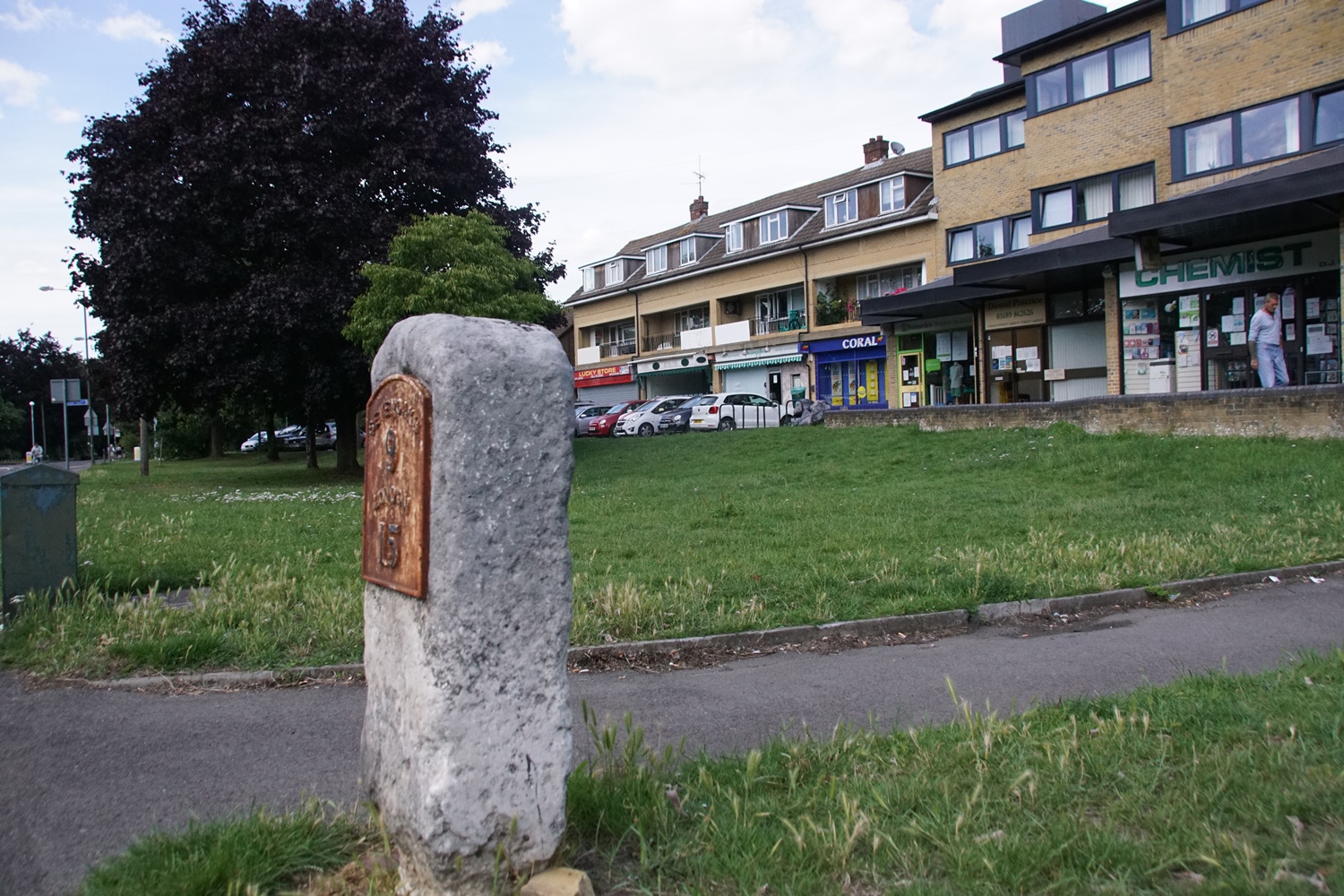 |
This milestone is located on the revised route for the turnpike, that came into use from about 1800. There is no surviving evidence of a milestone on the original route that used Old Hill.
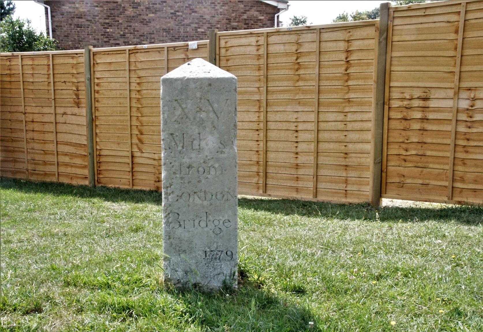
Milestone Tubbenden Lane (south side)
Milestone at corner TQ 46 NE 9/401
of Dalton Close and Tubbenden Lane.Milestone. Dated 1779. Limestone. Square plan.
Pyramidal top; inscribed XV/ MILES/FROM/LONDON/BRIDGE; date 1779 inscribed beneath. Located on the New Cross Turnpike road of 1718.
 |
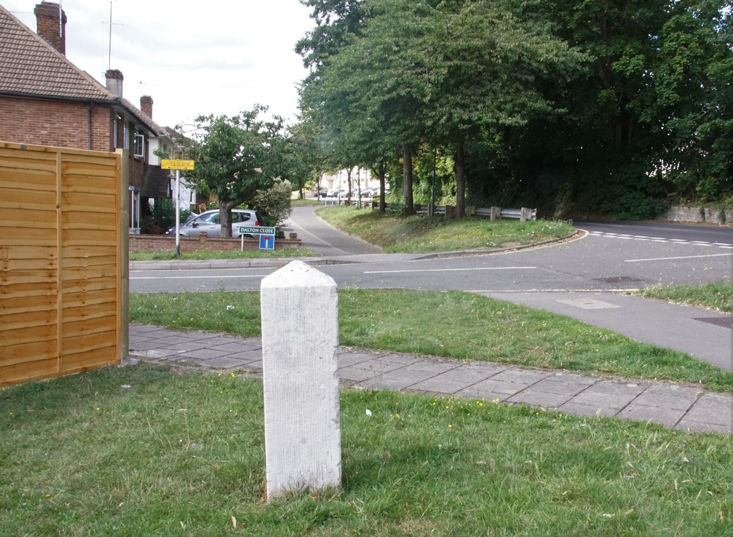 |
The location was formerly the entrance to the Tubbendence estate, and is marked on the second map on the Tubbendence page. The road shown is called Dalton Close, after George Dalton, a 16th century owner.
Nick Reynolds
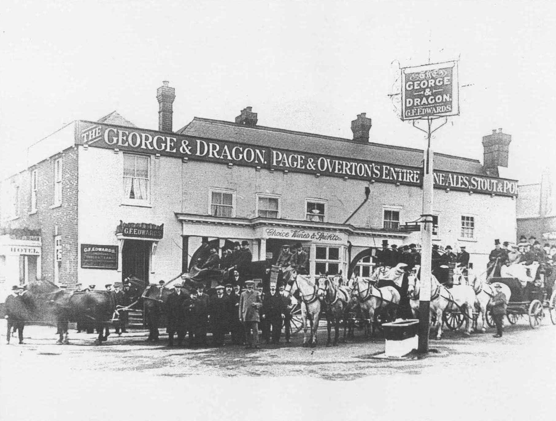
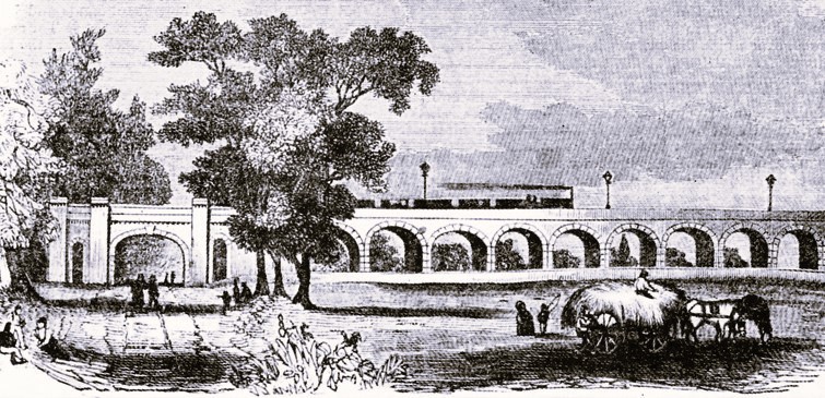
TURNPIKE ROAD